Abandoned and orphaned wells can cause significant headaches for developers, making it essential to locate and manage them using an accurate and efficient method.
The history of U.S. oil well drilling goes back to 1859 with the Drake Well near Titusville, PA. Over the next century, operators drilled hundreds of wells downstream along Oil Creek. But the area illustrates a serious issue throughout oil and gas country—most wells were not mapped or documented accurately and even The Notorious Inadequacy of state well databases don’t contain reliable information about their location and construction.
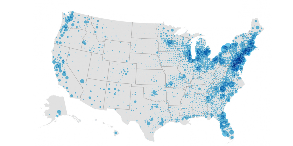
The number of abandoned wells is staggering—researchers estimate Pennsylvania ways to work around well-location challengesalone has 100,000-300,000, with more than 3.44 million abandoned wells across the United States, according to the Environmental Protection Agency. Many were left open to the environment when abandoned and never adequately plugged. And that oversight haunts owners and developers who must deal with these wells now.
Numerous Obstacles Hinder Abandoned and Orphaned Well Location
Until the 1950s, most states did not have modern drilling and plugging regulations. Operators proposed wells that weren’t drilled and drilled wells that weren’t marked on a map. Even if drilling and mapping occurred, wells may be hundreds of feet or more away from the plotted location due to faulty surveying. Given decades of haphazard recordkeeping, searching state databases isn’t enough to identify and locate all wells on a property.
That’s a problem for landowners and developers. The safest course of action is to determine if a property contains wells before breaking ground on a project—and it’s mandatory for analyzing methane emissions or toxic chemical leakage in the field and remediating the site. But in addition to missing records, obstacles to finding wells include removed, concealed, broken, or rusted surface equipment, overgrown vegetation, and inaccessible sites in waterways or buried under buildings.
According to a 2021 presentation at the American Geophysical Union, ways to work around well-location challenges include understanding data limitations, accessing historical and local expertise, verifying potential sites in the field, and remote sensing. In particular, remote sensing improves efficiency of field-based well location by enabling researchers to survey large swaths of land quickly.
Drone Magnetometer Surveys Approved for Viable and Cost-Effective Well Location
Most oil and gas wells use steel casing, so they have a characteristic magnetic signature identifiable with a magnetometer survey. Although magnetometers were previously too heavy to conduct surveys with drones, UAV Exploration (UAVEX) pioneered technology that allowed Unmanned Aerial Vehicle (UAV) Magnetic Surveying for well-locating. Our method uses lightweight magnetic sensor technology, highly specialized aerial platforms, and expert-level flight operations.
This leading technology makes large-scale well surveys not only feasible but scalable. In fact, our methods have become the standard used by regulatory agencies that require well surveys before project approval. In addition to locating wells and complying with regulations, our surveys support site assessment, safety measures, infrastructure design, cost estimation, environmental sustainability, and long-term operations—all the information you need to be confident when you build in oil and gas country.
For more information on the state-of-the-art in magnetometer well surveys, click the Contact button above, call us at 724-432-2999, or email us at contact@uavex.com.

